0.38 Acres of Indiana Land for Sale North of Marion in the Countryside with Owner Financing Available!
PAYMENT OPTIONS
SELLER FINANCING
DISCOUNTED CASH PRICE
Reservation Process: If you are interested in reserving this parcel, please choose a reservation method (cash or seller financing) and then click “Reserve Now” button. You will be redirected to our payment page to make the reservation payment of $199 and submit your contact information for the contracts.
Please visit our frequently asked questions page if you would like more information about the purchasing process!
DETAILS
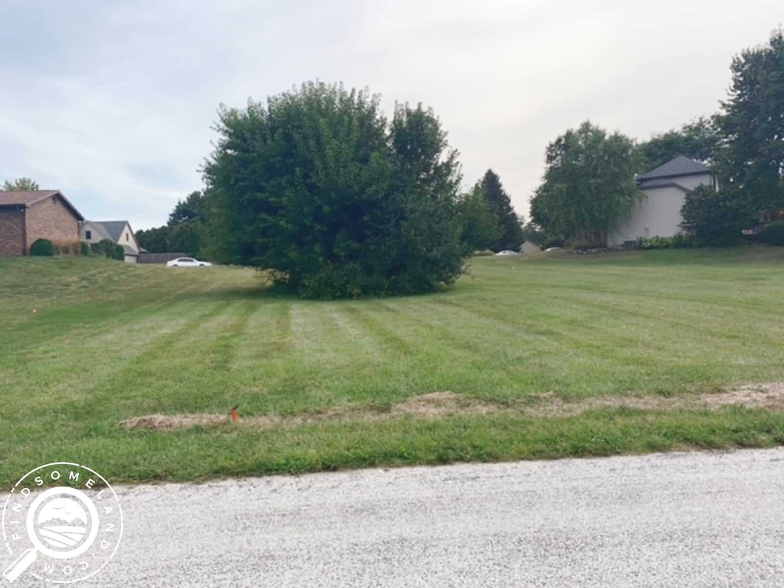
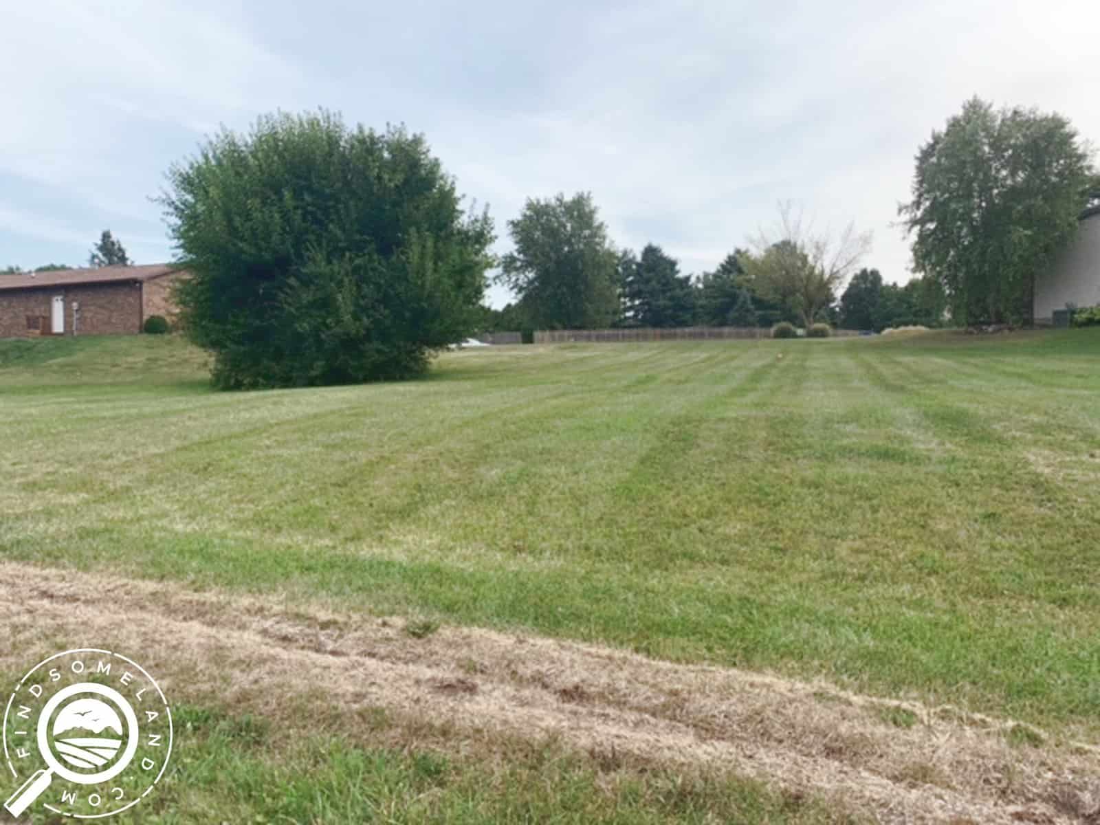
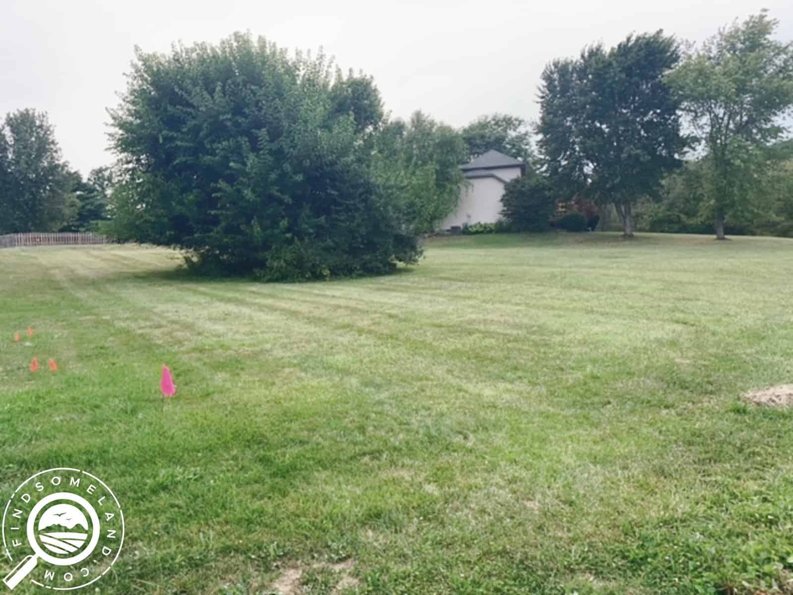
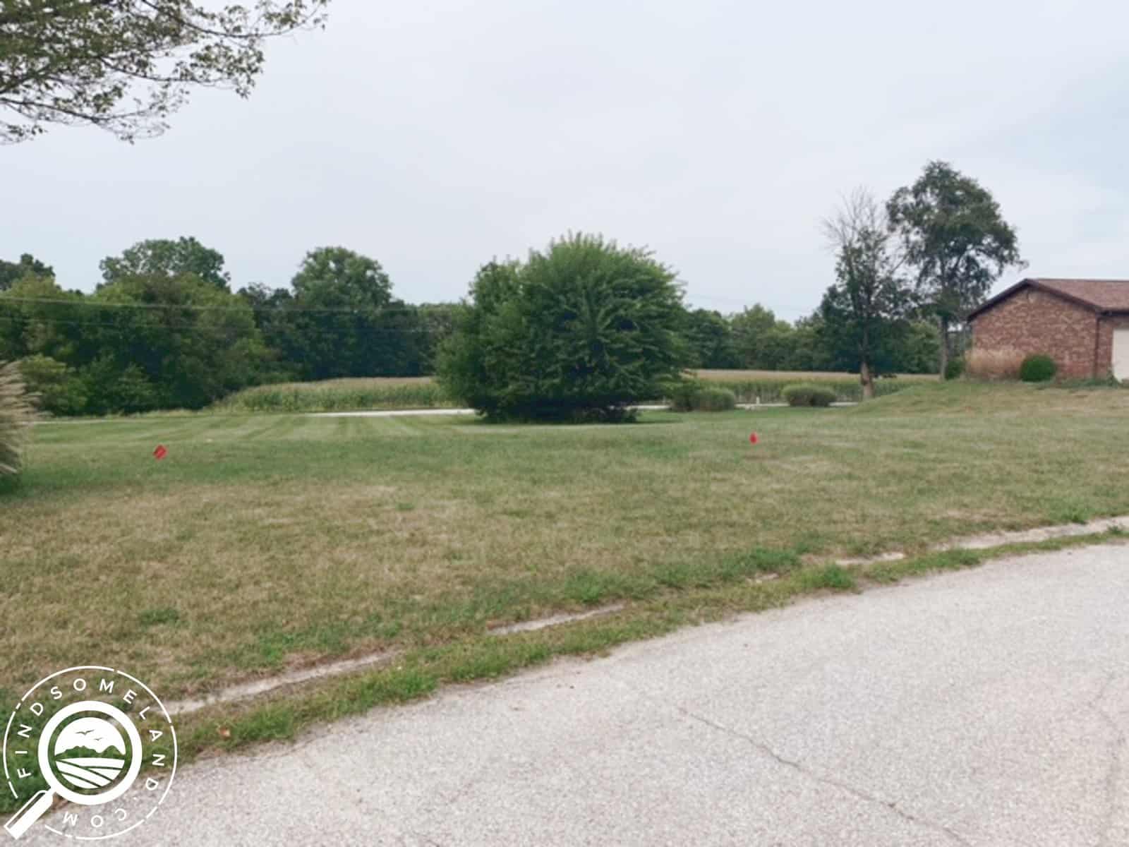
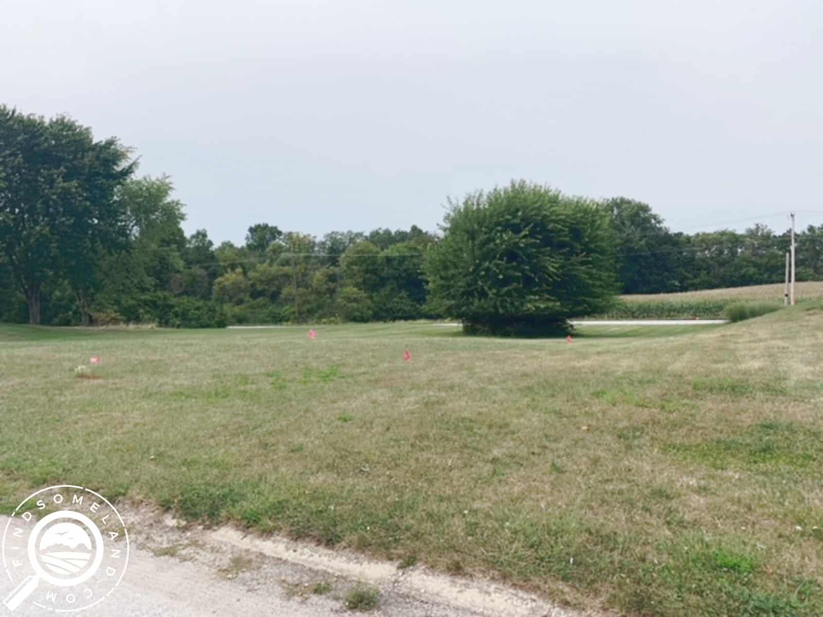
Nice houses around this property with plenty of open fields to look at! Less than 2 hours from Indy! This would be great spot for a storage building and maybe a large garden as the property is not large enough for a traditional septic system to be installed and municipal sewer is not yet offered there. This of course could change later but we still significantly reduced the priced accordingly. It has electric access available there as well!
Find your best use for this land and get it for the lowest price in this area! Close to the James Dean Art Gallery and the nearby towns offer conveniences with a little bit of Country too! Fast food restaurants and grocery stores close to the everything! Start using the property within a few days after the signed sales agreement and the down payment is made.
Located next to great historical sites like the Sycamore Stump & Old Ben! Lots of potential uses for this under priced property! Not currently suited for a residential lot because of its smaller size. Owner Financing is Available!
Purchasing Options:
Seller Financing: $8,500.00. $850.00 down and $185.77 a month for 96 months. The total monthly payment includes: $124.33 of principal & interest, $20.00 loan servicing fee, $30.60 property taxes, and $10.83 HOA dues. There are no prepayment penalties!
** Monthly principal & interest of $124.33 based on a financed purchase price of $8,500.00 less the downpayment of $850.00 for a net amount financed of $7,650.00 that is payable over 96 of equal installments with an amortized interest rate of 12%.
Discounted Cash Price: $7,500.00.
Nearby Attractions:
James Dean Birth-site Memorial: https://www.showmegrantcounty.com/places/james-dean-birthsite-memorial/ Legendary actor James Dean and his family lived in the House of Seven Gables that stood on this site when Dean was born on February 8, 1931. This timeless memorial honors the star and the many accomplishments he made during his all too short acting career. Take a moment to reflect, pay homage, and honor his memory. Follow the James Dean Trail while you’re in Grant County to discover and appreciate the real James Dean.
Mississinewa 1812: https://www.mississinewa1812.com It was the morning of December 18, 1812, the morning of the Battle of the Mississinewa. Above the sound of fighting, smell of gunpowder and feel of death rose one of the most significant chapters in the War of 1812 and dramatic moments in the history of Grant County, Indiana. A search and destroy mission, the Battle of the Mississinewa was one of the major engagements fought during the War of 1812. It marked the first offensive victory of the American army during the war. When war began, the entire Northwest Territory (present day Indiana, Ohio, Michigan, Illinois and Wisconsin) became a disaster area for the United States. What had been a smoldering conflict between white settlers and the Indians erupted into full-scale war between the Indians and the United States. In swift succession, Forts Mackinac, Dearborn (Chicago) and Detroit fell to British and Indian forces. Those Indians who had been neutral now began aligning themselves with the British and threatened the United States control of the Northwest Territory. in September 1812, William Henry Harrison was put in command of the army. His orders: Protect the western frontier and recapture Detroit. Harrison believed the Indian villages along the Mississinewa River were being used as a staging area for Indian attacks on his army. Against this background, on Nov. 24, 1812, Lt. Col. John B. Campbell led 600 mounted troops out of central Ohio on a secret mission to destroy the Indian villages on the river. On December 17, 1812, Campbell’s troops surprised the first of four Indian villages, killing 8 inhabitants and taking 42 prisoners. They continued north for three miles, destroying three more vacated villages before returning to the site of the first village to camp for the night. Just before dawn on the 18th of December, an estimated 300 Indians counterattacked. When the shooting ended an hour later, 15 Miami and Delaware warriors lay dead; and untold number of wounded had been carried from the field. The two-day engagement had cost the lives of 12 federal troops and another 48 had been wounded. As many as 45 Indians may have died in the conflict defending their lands. Campbell’s half-starved troops marched in knee-deep snow for seven days as they returned to Greenville, Ohio, resulting in 300 casualties from frostbite. In an act of compassion, Campbell allowed the Indian women and children to ride horseback to Greenville forcing some of his own troops to walk. The Mississinewa Expedition was the most successful of Harrison’s military actions in the fall of 1812. It eliminated the Mississinewa River area as a haven for Indian resistance, restored the people’s confidence in the army, and secured the route of Harrison’s army for the recapture of Fort Detroit.
Paradise Spring Historical Park: https://www.paradisespring.org/visit Paradise Spring Historical Park includes a beautiful ¾ mile handicap accessible paved walking path at the east end of Market Street in downtown Wabash bordered on the south by the Wabash River. The path is part of the much longer Wabash River Trail which will eventually run from Lagro, Indiana, into Wabash following the Wabash River. The trail weaves between historic log cabins that were recreated in the late 1980s to commemorate the site of the October 1826 Treaty of Mississinewa (Paradise Spring), a treaty between the Potawatomi and Miami Indian Nations and representatives of the United States government including Indiana Governor James B. Ray, Michigan Governor Lewis Cass, and Captain John Tipton. The treaty signing opened the Northern Indiana and Michigan up for settlement and commerce. Through it, the tribes gave up their rights to more than 500,000 acres of land. Called Kincomiong Spring or “Running Water Place” by the native americans in the area, after the signing of the treaty, the area of today’s park was known as “Treaty Grounds.” In the years after the treaty signing, the grounds were sometimes called “New Comers’ Headquarters.” New settlers lived in the cabins that remained after the treaty signing until they could construct their new homes. The Council House, a replica of which can be found at the park today, served as the post office. In this building, annual allotment payments were made to the Miami Chiefs, elections were held here, and it even acted as a schoolhouse for a time. The treaty signing and subsequent settlement of the area led to advancements in transportation in the area. In 1837 the Wabash and Erie Canal came through Wabash and was followed by the railroad soon after in 1856. In 1872, the first Railroad shops were built at the Treaty Grounds which later became the home to the Big Four Railway Yards. The Big Four was made up of the Cleveland, Chicago, Cincinnati, and St. Louis railroads. The shops provided access to maintenance and repair for steam engines. At one time, the railroad was the largest employer in the City of Wabash. During the 1900s, the Wabash River was rich with many species of mussels. The shells were harvested and used for food, tool making, and as buttons which were made at the local button factory. Shanties populated the area and barges were constructed on the river for ease of harvesting the shells. The development of plastic after World War II led to a fall off of mussel harvesting. In 1902 a beautiful depot was built at the far west end of what is now Paradise Springs Historical Park. The natural spring on the grounds supplied water to the drinking fountains inside the train station. The natural spring has dried up but there is a stone marker made of Indiana Limestone in its place. Sadly it was torn down in 1966 after sitting empty for many years. The railroad shops closed in 1925 and passenger service to Wabash by train ended in 1950. From 1900 to 1938, Wabash could also boast to have an Interurban Electric line running through the town. As its track, it used the abandoned canal tow path. The City of Wabash purchased the Paradise Springs area in 1987. City employees and volunteers spent countless hours cleaning up and clearing out the areas to make it a park. In 1996, Paradise Spring Historical Park officially became part of the Wabash Park Department. However, programming for the park and maintenance of the cabins is still overseen by the Paradise Springs Historical Park board of directors. In addition to the written signs on buildings and throughout the park, QR codes have been added to further explain the history of Paradise Spring. If you follow the lower loop of the trail, there is a River Overlook and the path also connects to the 1 mile Wabash River Walk. Today the park is home to festivals and concerts, the annual Charity for Chili Cook-off, a place for family reunions and countless other visitors. Come enjoy the history of Wabash or just enjoy a leisure walk through a beautiful park. In 2013, the Paradise Spring board received an educational endowment from the Melba Johnson Custer Trust. The income from this endowment is designated to provide Educational Programming for Paradise Spring Historical Park. Specifically, this trust is setup to provide “…educational programming on the site of Paradise Spring Historical Park, open to the general public, diffusing knowledge of Indiana history, and particularly that of Wabash County and its surrounding area.” Today, in addition to enjoying a walk or run on the paved pathways, visitors may learn more about the history of the area using QR codes that are located on signage throughout the park.
Property Details:
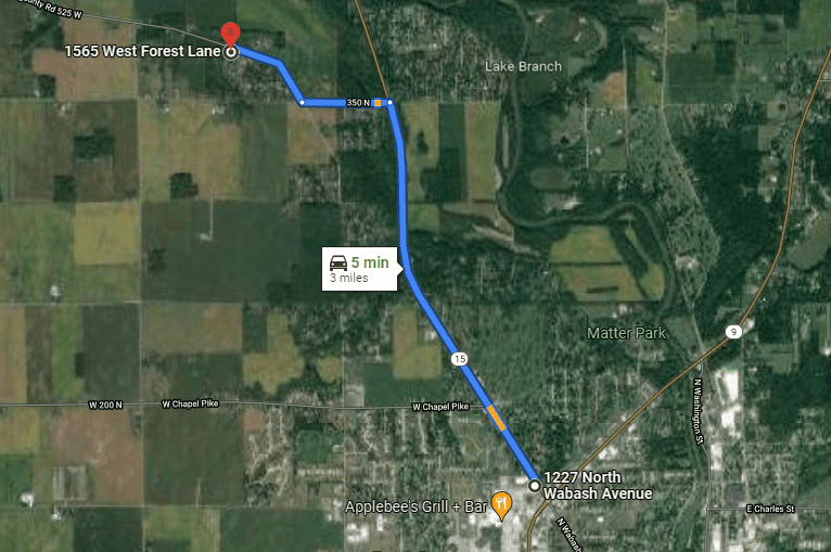
NEAREST LARGE CITY: Indianapolis, IN – 1 hour 30 minutes
STATE: Indiana (IN)
COUNTY: Grant
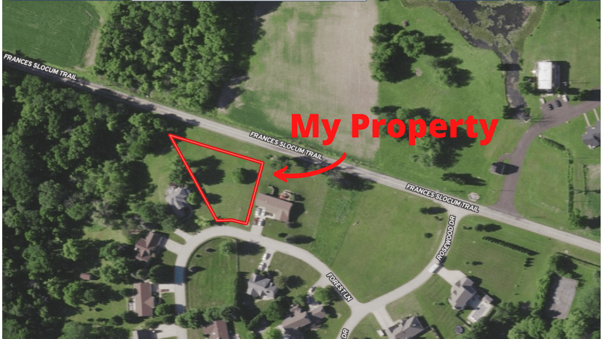
ADDRESS: 1565 W FOREST LN, MARION, IN, 46952
SIZE: 0.38 Acres
APN(s): 27-03-23-204-002.000-021 / 0 / 0 / 0 / 0 / 0
GPS COORDINATES: 40.60715097,-85.70402891
PROPERTY ELEVATION: 820 feet above sea level
TAXES: No back taxes, approximately $ 367.18 per year total
HOA Dues: Approximately $130.00 per year total
ACCESS: Paved
ZONING: Residential
SEWER: Onsite Septic Would Need to be Installed
WATER: Would be Well
DISTANCE TO ELECTRIC: On the road
FEMA FLOOD ZONE: No
TERRAIN: Level to sloping
CONVEYANCE: Special Warranty Deed
TITLE: Free of Liens and Encumbrances
FSL ID: IN-GRA-TS0223
VIDEOS

powered by Advanced iFrame
PROPERTY BOUNDARY MAP
powered by Advanced iFrame
DIRECTIONS AND INTERACTIVE MAPS
Google Maps Pin: This pin will allow you to use Google Maps to generate directions from anywhere in the world. Please click the button to use the pin.
MapRight Mobile Link: This link will allow you to use the free MapRight app to allow you to see the property boundaries using your phones GPS while on site.
The Fine Print
Any property information (including, but not limited to, all real property images, descriptions, pricing, locations and availability; hereinafter referred to as “Real Estate Information”) made available by or through this website is provided solely for informational purposes and is not guaranteed or warranted by Find Some Land LLC. Find Some Land LLC believes the Real Estate Information to be accurate and complete; however it is subject to change and/or correction without notice.
All information regarding the real estate advertised herein has been assembled through various sources and independent investigation should be conducted by all prospective buyers. Please verify all Real Estate Information through public records available through the County Clerk or Registrar in the county where the property is located. Buyer is responsible for conducting due diligence.
If purchasing with seller financing, the contract for deed stipulates that the property all improvements to the property must be approved in writing. Please feel free to contact us if this is an issue for you so that we can discuss your specific situation and plans. The approval can and will be provided at the same time as the contract documents.
RELATED PROPERTIES


